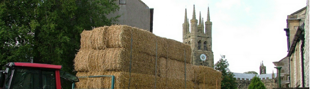
I was lying in bed after a particularly exhausting week of work when I received a text, a bit out of the blue from Dean Read. I’d messaged him a few days earlier, commenting on his videos, and suggesting that we meet up and go for a trek somewhere. We’d talked about going walking together before, but for one reason or another, we hadn’t managed it.
Dean has, over the last few years amassed a fantastic YouTube channel with lots of videos of walks across the Peak District and beyond. You can see his work at peakroutes.com and deanread.net.
I was naturally pleased to be going walking with someone who clearly has a detailed knowledge of our local area and also a keen passion for it, as well as a passion for sharing that passion with other people, who might want to know more or who perhaps aren’t able to get out to the higher, more challenging parts of the Peak District.
We settled on a route around Kinder and Dean came up with the final route, being as he knows the area and is the more experienced of the two of us. Even though I have lived in the Peak District for most of my life, in recent years I’m discovering that there’s still a huge amount of it that I still haven’t discovered fully.
Barber Booth
After a bit of a kerfuffle to begin with I finally met Dean at Barber Booth car park, we climbed over the Stile at the bottom of the road near the railway bridge and headed on up towards Kinder Scout over the fields.
As we climbed we talked, covering a multitude of topics from walking, vlogging, family, diet and exercise and other topics. Dean is an easy bloke to spend time with, and easy to chat to with for sure, and I felt like I’d known him for ages.
We were instantly immersed in nature after a little lamb came up to us for a snuggle, and then further up the track, we spotted a small Common Lizzard on the flagstones, that was awesome for me as I’d never seen a Lizard in the UK before.
Looking back toward Edale from the path out of Barber Booth
Edale Head
Brown Knoll & Edale Head
We headed onto the hard flags toward Brown Knoll. The flagstones are a topic that divides opinion, some people like them and some loathe them. As a fell runner I’m really not at all keen, however, I do see the need for them due to increasing amounts of people who are walking and cycling in the area. Without such measures, the erosion would be devastating to the moors. So a necessary evil in my opinion. From there, we continued on towards Edale Head.
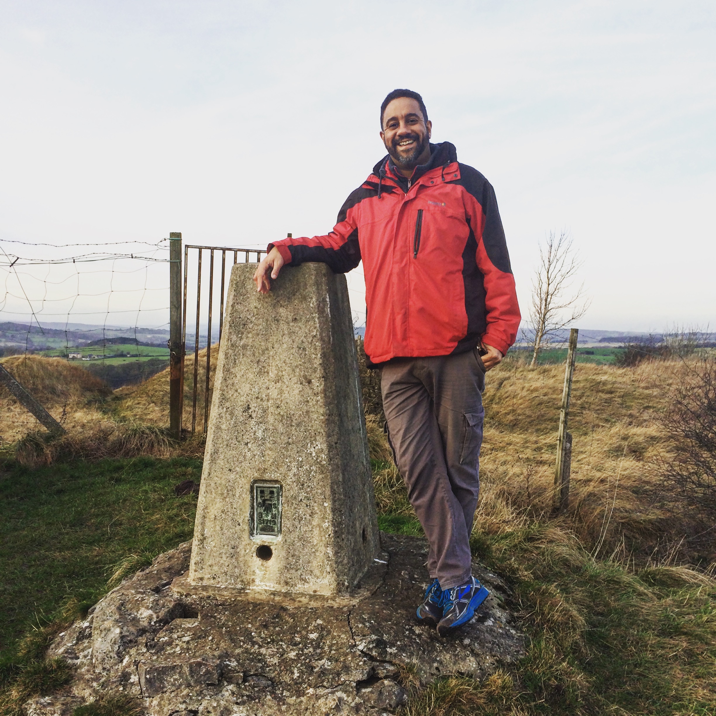
Kinder Low Trig
Kinder Low
As you get up toward the top we passed the top of Jacob’s ladder, I hear a lot about this being a challenging path to walk, I’ll look forward to trying it one day. We pushed on a little further to the Kinder Low Trig. Dean did a bit to the camera and then that’s where we took a break and had some lunch.
From there, we pressed on, heading up to Kinder Downfall, although the day was hot, the views were a bit hazy over toward Manchester. We did get a great view of Kinder reservoir though.
Then, further on, we had a nice view of the Mermaid’s Pool too. Then further on we were treated to the great escarpments of the downfall, there were some seriously big rocks all stacked up rather precariously.
Kinder Downfall & The River Kinder
Cliffs at Kinder Downfall
Cliffs at Kinder Downfall
Dean Read exploring kinder downfall
After doing a little scrambling and exploring at the downfall we moved on, up the River Kinder, and marvelled at its unusual river bed. It had literally worn its path through the gritstone. Leaving a course, gritty sand as its bed. I was amazed at how little water was actually flowing so early in the year.
from there we moved through the Groughs, looking at the great work being done by moors for the future All along the Groughs, there were signs of the repopulation work they had done putting back heather and Sphagnum Moss. There were mini dykes holding pools of water helping to form new peat bogs.
Then we reached the official summit, which was actually little more than a lonely tussock of heather on a raised but of peat, no more than about 3 ft across. You could easily miss it if you didn’t have a map or GPS bearing. We meandered on coming eventually to Pym chair. There is another Pym chair in the Peak District, the other being at Goyt valley. Names tend to get re-used around here, just as there are 2 or three “Back Tors”, and several “upper towns”.
Pym Chair – Kinder not Goyt
Woolpacks
Next, we came to the Woolpacks. The woolpacks are a huge collection of extremely weathered rocks, they look as though they are made from a different type of rock to the Gritstone we see all over the moor. Perhaps someone will set me straight on that but I thoughts they seemed a different type of rock. Anyway, they are so intensely weathered that they had some fantastic shapes.
Baluga Whale?
It seemed to me that there just couldn’t be any more treats and surprises. I was wrong.
Crowden Tower & Clough
We came next to Crowden tower with its spectacular views overlooking Edale and the deeply carved gully that is Crowden Clough. We decided to climb down the clough, just for the hell of it.
Crowden Clough
I hope that you enjoyed these photos and my account of the walk. If it was a bit too long for you, please feel free to watch the video. There’s a transcription below for those who need it, and the video has closed captions. (subtitles).
PG: Hello there, Tideswellman is back out on the moors. It’s been a long time I know, but finally we’ve got some kit that’ll do the job and we are out on Brown Knoll. I’m very pleased to introduce to you, a chap who I’ve been trying to get out walking with, for a long time, Dean Read of Peak Routes. Hi Dean, DR: Nice to finally meet you mate, Pg: Yes, Really good, do you want to tell the viewers, where we are going to go today?
DR: the plan is, quite a rough plan, we parked down at Barber Booth, we walked up to Brown Knoll, and head on up to Kinder, Downfall, maybe across to the summit and then, see what happens from there. It’s gonna be a good day!
PG: so there you have it, we’ll be taking footage as we go along and I hope you enjoy this walk with us.
Here we are at Kinder Downfall, we only have a trickle today, but that does not detract from the awesome beauty of what we are looking at.
Earlier I saw somebody trying to climb up, there. Wow!Good effort! And some others over here, I think they are going to have a more tricky time, as they have taken a more difficult line, unlike us who are on the top.
DR:Easy win!
SO we are here on the top of Kinder river. the downfall is behind us there. If I turn the camera round, you will see the river, and it’s quite extraordinary really as it’s just flowing over the top of stone. Slabs of stone, and the water level is super low already and it’s only May.
There is hardly any flow at all. I’m not used to seeing the rivers this low, there is still some life in there though, I’ve seen a few water nymphs and freshwater shrimp. There’s some kind of creature skimming around in there, I don’t know what it is or if you can even see it , it’s so small, but there is LIFE!
This is what we are having today, Life, a fantastic walk over Kinder Scout.
We have been walking fora bout half an hour now in these Groughs (Gruffs) . Which are little channels in the peat and they are everywhere, and go off in all directions and in bad weather people who are underprepared have been known to get very lost in them. Thankfully we’ve got GPS and Maps and a bit of experience about where we are going.
As you can see, this brown soil is the “Old Kinder”, Dean was telling me about how “Moors for the future” have been working really hard to repopulate this surface with heather and gorse so you see the green moor we see today. Apparently, it was previously all like the brown soil we saw in the bottom of the Groughs there.
There’s not much variation in the landscape, so you could easily end up walking a good kilometre in any direction with no discernible landmarks. So you have to know what you are doing.
So there it is,
the most impressive (sarcastic)summit of Derbyshire. this tussock of grass and Peat is the official summit of Kinder Scout.
Wind and footsteps noises –
Now for the first time we have a cool breeze, I don’t think we have had a cool breeze in all the time that we have been walking, it’s been pretty warm.
Those of you who aren’t from the Peak District, and who know me or follow on Facebook or Instagram, if you are ever planning a trip to the Peak district, Kinder Scout, Edale, Hope Valley, these are the areas that you really must make a bit of time to visit. Give me a shout if you are up here, I’ll happily come with you.
As you can see it really is a landscape to die for. *Laughing not sure that’s the best metaphor.
DR: Perhaps not die. To live for!
PG: Now we are coming into an area with all these weird rocks. these are the Wool Packs.
I guess you can see why. Once upon a time wool would have been gathered up and left on moors for collection in big bundles. I guess they do look a bit like…..Whoooargh (FALLS)
I’ll keep that bt in, walking and filming, lol, the pitfalls!
It’s almost like a Neolithic landscape, It looks like stone henge or something like that.
DR: it looks like they have been dropped here from a different universe!
PG: Fantastic
Now we are on Crowden tower. Look at the view, if I can get the camera up high. I’ll go to the edge and you can look over my shoulder down into the valley. The camera never ever does the view true justice to what I can see with the eye.
We are on the final bit of our walk now, this is Crowden Clough, and we are going down there, where the water goes, or should be going there isn’t much today. If you come here at this time in November there is a healthy flow.
I just want to take a second to say, how completely blessed we are, I don’t like to say that often, it’s an overused phrase on the internet but I think we are blessed to live in a place like this, where you can come out a few miles from home and have all this on your doorstep, FANTASTIC!
Down and down and down we go.
This is quite a good climb, particularly for me, Dean’s been on this route before many times, he seems to have handled that with no problem so I’ll give it a whirl.
There you go, we have just come down there. I feel quite happy with that.
After quite a good climb down, we finally found the water. Look at that, crystal clear! And there you are…We are down.
The stream has split off into 2 forks, we followed that one, and we are back down. It was quite challenging!
Walking through the bluebell woods now at the side of the Crowden brook and we have just come down from the clough, we are in the shade at last, out of the exposed Sun as you can see the beautiful bluebell wood and are making our way down to the road. soon we we will be back where we started.
there you go have a look at that old telephone box, it still has a working phone, beautiful, you dont see that very often these days.
And here we are, back where we started. Barber Booth.
Closing comments:
Just walking down now from Barber Booth, I have just left Dean Read, and we have had a fantastic walk. We started around this area, and we’ve been up onto Kinder, as you’ve seen through the video..we’ve done a good loop and down then clough.
I just want to say thanks very much to Dean for showing me that route, we’ve been in touch on social media for a long time and finally, we got to go out together for a walk today. He’s an incredibly knowledgeable chap and terribly humble and it’s been a real pleasure to go trekking with him.
Dont forget to subscribe – or click the next video box if you enjoyed this film.
The last year has been a year of change for me. A massive amount of change, in fact, perhaps the most change in a one year period that I can remember.
Change isn’t always welcome, but more than often necessary.
Part of my general life philosophy is to not look back. Being a lover of history, and of documenting it, I do look back occasionally, but only to record and reflect, I rarely look back with regret. this is the first in a series of posts about changes that have affected my life in recent times, and how I feel about them.
Normally, I’d never watch anything like that because it seemed to suggest that animals might be hurt, or not treated nicely in the video and I’ve never been a fan of hurting animals. Most of us aren’t but we pretend it’s not happening.
Anyway, for whatever reason, I watched the video and I didn’t like what I saw. Well, actually, I liked the way it was put together but it just horrified me. It made me think very differently about the way that animals are treated in the name of the greater good.
I’ve eaten dairy products since I was a child, just like the vast majority of people. I also enjoyed eating all variety of meats derived from farm livestock.
After a few days reflecting on the video, I started thinking more about how I aspire to stop eating meat and all animal products.
One day at work, we started talking about cruelty to animals and I mentioned that one of my long-term health ambitions was to become a vegan. Sadly my proclamation was greeted with the usual ridicule. Indeed one colleague baited me saying that there was no way I could do it because I liked my Sausage and Bacon butties too much. He was right about liking the butties, but wrong about whether I could do it.
Right there and then I said, “I’ll start by going vegetarian right now”. Again, it was laughed off, but that was June 2017, and I’m still a vegetarian, and certainly not looking back. I do not miss meat of any kind. In fact, the thought of eating it makes me feel ill.
I had no real issue giving up Meat and Milk wasn’t such an issue, as I knew there were plenty of substitutes. Nowadays my replacement milk is oat milk, it’s delicious and has a very similar texture to cows milk, with minimal flavouring. I wasn’t so sure I could give up cheese and eggs. this has proved difficult, but I’m sure now that it can be done.
This change couldn’t have been done without the help and support of my partner of course who, in her younger days been vegetarian and so has endeavoured to research, cook and prepare many fantastic vegetarian meals. Thanks to her great research, We’ve also been trying more and more vegan recipes over the months, and I feel much more confident that the transition from Vegetarianism to Veganism could actually take place sooner rather than later now.
Talking to others about Vegetarianism
By and large, I have avoided too much public comment on the subject. I had 2 conversations on social media about “not eating meat” which ended in disaster. I’m no stranger to controversy, particularly on political matters but in both cases, I didn’t look for confrontation. It’s my policy to not tell others what they must do. Everyone has to choose for themselves what they do with their lives but that won’t stop me speaking candidly about what I believe and why I have chosen this path.
One old friend made a facebook post about “Vegan Zealots”, in this post, he went on to say that he loved animals but wouldn’t be dictated to by zealots. I decided to point out what I saw as the flaw in his argument, I said:
“You claim to love animals, and yet you’re complicit in their deaths so that you can eat them and wear them, that makes you a hypocrite.”
Just reading that, I imagine a few people are getting mad. But stop! I was exactly the same as my “friend” I loved animals but was complicit in their deaths, and actually still am as a vegetarian.
It doesn’t change the fact that to say you “love animals”, and then eat them for breakfast dinner and tea, makes you a hypocrite, whether you like that label or not.
I don’t think that I am better than any meat eater because I’m not. In fact, I’ll never try to convince anyone to become veggie or vegan…its up to you. You want to eat meat, do it, but if you proclaim to “love animals”, you may be called a hypocrite. That will smart, but it’s the truth. You’re stuck, you can either do nothing and bury your head in the sand. Trying hard to convince yourself that meat and dairy have nothing to do with animal cruelty, or you can try to work out a plan of action to disassociate yourself from it.
I’ve found that people get defensive about “their right” to eat meat. Well, I’m not stopping you from eating it, but why does the argument that it’s immoral upset so many people? At least hear the arguments.
Every person on Earth must do what they believe in their hearts to be what is right. That is what I’m doing.
Over the years I have campaigned against racism, discrimination, and talked and written at length on the horrors of slavery. It’s my belief that eating meat and dairy, actually contributes to a system of slavery for animals.
I don’t want to be a hypocrite, that’s why I’m taking steps to become a vegan.
Do Vegetarians and Vegans Change Anything?
I fully accept that my becoming a Vegan won’t change the fate of billions of animals worldwide, but what it will do is remove my money and endorsement from that system of animal slavery, torture and death.
Anyone who cares to speak to me about such things and agrees with me, and then embarks on a similar course, is one less person/family who is making a change for animal welfare, as well as their health and conscience. In fact, it’s already happened, one friend told me that by me raising awareness about why I was becoming a veggie, inspired her and her husband, and they are now both Vegans and thriving.
This post isn’t a crusade for veganism. There are plenty of better writers, nutritionists and animal rights people who can do that better than me. This post is just about my journey, and becoming a vegetarian is only one part of my journey toward a happier me.
Feel free to comment. Happy to debate with anyone who doesn’t share my view, but let’s try to keep it hate free.
Today, I had a proper nightmare on my run. I haven’t had such a run for a long time. The problems were many and all my fault from start to finish. It just goes to show, that even after a few years of running, you can still get it badly wrong if you don’t plan it properly.
Fell Running Mistake #1 – The Distance
I have been toying with the idea of doing a half marathon equivalent on the fells. I’m sure I can do it just based on other long runs I have done before. So I thought this might be good practice.
However, I didn’t measure the distance first, and I was way too ambitious with the distance given that I haven’t done a really long run for a while, and I’m as big as a barrel after Christmas.
My route was 19k with 250m of elevation. What was I thinking? Really? Hubris, pure hubris!
Fell Running Mistake #2 – State of Mind
I really wasn’t that up for it, I’d planned to do a simple park run in the morning but due to ice, the thing had been called off, frustrated and tense, I was desperate to get out and run hard no matter what. In addition to this, I forgot to pick up my inhaler, I am a long time asthmatic. 90% of the time it NEVER troubles me…whenever I run without an inhaler, it bites. Must be psychosomatic, but it can be a real pain and a bit of a worry if you’re on your own.
Sometimes, It’s best to just have a short trot out without too much pressure. Runs are always harder when you’re not in the mood, so why put added pressure on yourself by not knowing the distance and conditions?
Fell Running Mistake #3 – Not properly Dressed
You can never mitigate for the conditions when fellrunning, just a few weeks ago we were out on a run and it was just chilly, 30 minutes later it was snowing really heavily. I always have a decent jacket and hat, but almost always forget to take my gloves, today was no exception. It wasn’t too cold on the hands, but, it could have been especially as the wind started pick up. I didn’t take a headtorch with me, I should have because the route was more challenging than I thought, thus I was slower, it was getting dark by the time I hit Elton.
I did have my bum bag with FRA kit on me and thankfully didn’t need it. The wind was blowing quite a lot as I climbed the first hill up to the trig, but thankfully left me alone after that.My issues arose from footwear. A few weeks ago I picked up some Walsh PB Elites. I’ve only used them once, on soft fields and damp woodland trail, they were brilliant. Today, they weren’t the right shoe.
Firstly, the Walsh is a very flat shoe, and there was a lot of hard trail and tar in today’s route. Also, today’s route had a lot of saturated mud and hard rocky limestone paths. The mud was almost pulling the shoes off, and the rocks were giving my feet a pummelling.
My left feet was sore before I went running, it was much worse after. My Fellraisers always protect my feet from such conditions and are not as shallow so hold the foot in place much better than the Walshes.
Fell Running Mistake #4 – Route Not Reccied
I did plan this run using a map, and had my map with me….but I suppose this WAS the recce. That said if I’d have reccied it before I would have certainly made route changes and opted for the Fellraisers over the Walshes.
If I’d have reccied the route I’d have known that the stream in clough woods was totally flooded. Never seen that before, it’s usually a dribble. Tonight it was flooded over the path least 6inches deep. I tried to go round it and discovered a marshy area. I had to bite the bullet and go wading. I really need to do a refresher navigation course with Pete Hawkins, and remember my map.
Catalogue of errors – Follow Basic Safety Steps
1) Tell someone your route, I did not.
2) Take a head torch – I did not
3) Take your life-saving medicine – I did not
4) Anything over 10k, take some water – I did not, luckily I was able to eat some snow, and wasn’t dehydrated according to my failure to create yellow snow, a bit further on.
Other Pics:
Despite all the horrors listed above, I have to see this as a learning experience. It’s a good reminder that man is NOT greater than the environment, and to be prepared, even if you feel confident, don’t take silly chances, even experienced fell runners can die in unforeseen circumstances.
Thanks for reading! if you enjoyed this piece please consider sharing it around, liking me on Facebook, following me on Twitter, bookmarking this website, throwing some money into my hat on Patreon or Paypal.
Oker Hill is one of my favourite local fell running destinations. Oker Hill is a relatively small hill that extends from the side of a larger bank. It sits between Darley Bridge and Wensley, Or if you’re heading on the back road from Matlock, just above the Hamlet of Snitterton.
It has a white painted trig point that makes it clearly visible from both high and low viewpoints around the Darley / Matlock area.
My usual route to the trig starts at the Church Inn, Church Town, Darley Dale, I follow the road around the corner past St Helen’s Church, turning immediate right over the fields past the dog kennels. Follow the path across the first field and you come to a broad arable field on the floodplain.
Head toward the Cricket ground and this will bring you out at Darley Bridge. Head over the Bridge and swing left down the lane called Wenslees. You’ll have the River Derwent on your left, just after the Water Treatment plant, take the stile through the fields on your right.
Most of the year, this field is boggy, expect wet feet, if you don’t have waterproof footwear. Fell runners do not care about such things, we welcome wet feet.
You’ll come to a small stile, go over and up the next field, it brings you out on a farm track called Flint Lane, Turn right, about 10 meters on your left, take the next stile and go up the next field. This field is steep and undulating. Depending on the time of year, there may be cattle or sheep in the field. If you have a dog with you, ensure it’s on a lead to avoid spooking the livestock. I have been chased by bullocks in this field so beware.
As you climb to the top of the field there’s a gate on your right, keep going up, under the Hawthorne trees, and you’ll see the land on your left rise sharply. Up and up and you’ll come to what looks like a little ski slope. If you’re fit, you can run up this in one go. If not, you know you need some training. It’s a short but steep hill and when you get to the top you reach the trig point and are rewarded with fantastic views.
South Darley Church
Looking towards Wensley
I really like this little route because it gives you a reward, without killing you in the process. A relatively easy trig with great views, but you still have to make a bit of effort.
After you’ve caught your breath and taken in the view, head along the undulating path toward’s the big tree, you might spot a rabbit or two if you’re lucky. At the big Sycamore tree, there is a little shrine, I don’t know the detail behind it, but someone either loved this place or lost their life here.
Now follow the path past the tree, through the scrub and you’ll come out on the other side of Oker, to your left is an old derelict barn and your way back.
Oker Hill, Head down toward the barn.
Head down toward the barn, you can now turn right into Oker and take the bottom route or head left and you’ll be heading back the way you came, just slightly lower down the hill.
Look for the shard. The shard is just my name for a sharply pointed guidepost on the path, resembling it’s more modern, London counterpart.
All you have to do now is follow the path, you’ll come out at the foot of the steep incline up to the trig. Go back down, retracing your steps and back to the pub for a well-deserved drink.
Share & Enjoy If you liked this blog, please share it on social media, using the buttons below the post.
If you wish to use any images from this post ( or any others on the blog, you are free to do so, but please credit me by linking to the page you take the images from.)
copywriting course by the CMPI added the strapline, “Loving Local Landscapes” to this blog in early 2016. It was in response to an assignment for work, that I was undertaking as a part of a copywriting course by the CMP.
It’s been a busy year in general and my personal direction has altered a few times, wrestling with where the line should be with my public and private persona and just what I want to share online. I have long been a lover of nature and history, and yet my tweets are often political, as is the material that I post on Facebook. I feel the two worlds are not always compatible and should not bleed into each other, keeping both strands pure for those with similar interests. Nature lovers may not want politics and Politico’s may not care for updates on hill and dale.
Subsequently, all posts of all types have suffered from my hiatus, whilst I ponder exactly how to separate the content appropriately to ensure the right audience gets the right material.
The Direction for 2017
This Weblog shall remain mostly apolitical, focusing on the landscape and history of the Derbyshire Peak District and my interpretation and interaction with those elements. To underline that commitment, Here’s a little of what I’ve been up to at the end of 2016.
Crich Stand Trig: One of the easiest in the area.
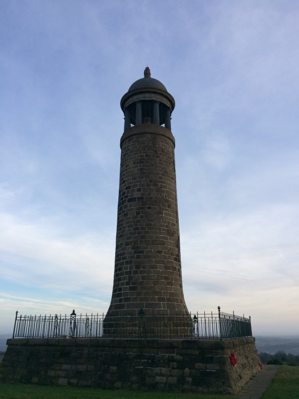
A Trip To Crich Stand
The Crich Memorial (known locally as Crich Stand) is one of those places that has been on my list to visit for a very long time, and yet it’s one of those places I never seemed to get to, until now.
Despite having visited the tramway museum a few years ago, having had relatives in the area, and visiting friends in the village itself, I’d never gotten up to Crich stand itself, much to my annoyance.
As I’m sure any walker/runner will know, all too often we pass a place in our cars and vow to investigate, and yet allow life to jostle us past every gaping opportunity. Well, no more.
After the excesses of the Christmas holiday, Mum and I headed up to Crich with the aim of wandering up to the Stand. It was a cold crisp day, we made the stroll very steady.
I believed that The Memorial tower was dedicated to the fallen soldiers of the Sherwood Foresters (Nottinghamshire & Derbyshire Regiment). I was unaware though that the regiment had been merged with the Worcestershire Regiment. Today that merged regiment is part of the Mercian Regiment, all part of Army restructuring.
We wandered around looking at the inscriptions on the War memorials to the dead that have fallen since WW2, took a few pics and walked up to the trig, peering down into the Tramway Museum below.
There was a chap flying his Drone up there, getting some ariel footage and just generally enjoying the views. We exchanged pleasantries, and Instagram handles, though I couldn’t find his account, perhaps, he’ll find my Instagram or read this?
Sadly, the tower itself was closed, but we do hope to visit again and perhaps get to take in the view on that occasion.
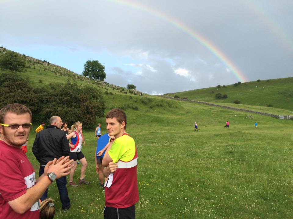
The evening of June 24th saw the 2016 Tideswell Fell Race. The venue is Tideswell Dale. This year, 85 runners took part, which is a good turnout. I think there were a few more than last year.
It looked as though rain may stop play before the fell race even began. Dark clouds were overhead and they unleashed a deluge of large hailstones. Luckily the heavens cleared and blue skies soon chased off the dark clouds.
I arrived early at Tideswell Dale with just enough time to record a quick snap chat about how I was feeling before the race. It’s a nice race with a bloody tough climb quite early on.
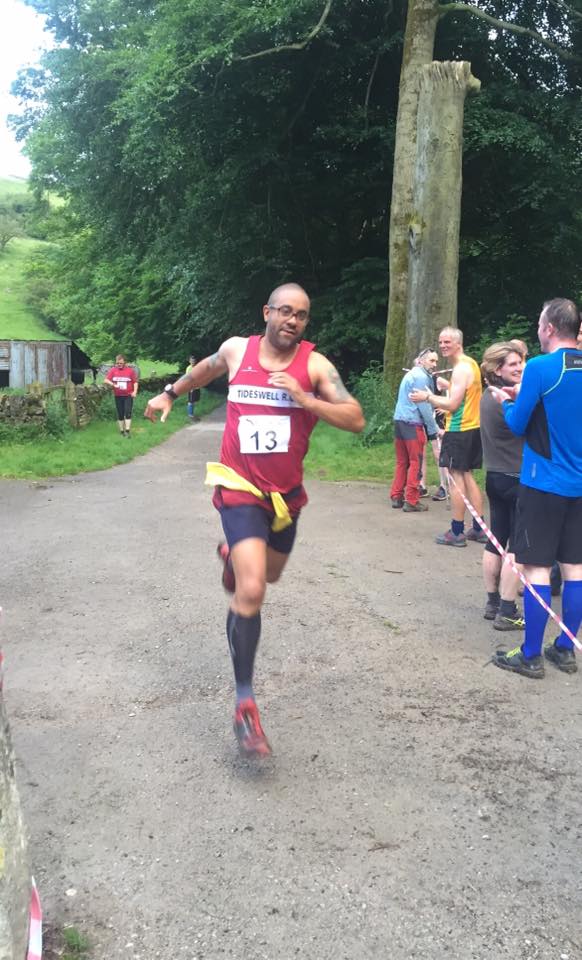
When I arrived I went to sign in and collect my race number, which wasn’t great, it was number 13. Not a good omen in my opinion and so it was proved. I’d told my friends Jo and Nick and they came along for the race too.
Will Brindley & Glen Croper…enjoying the rainbow.
I and my fellow clubmate Will Brindley headed up into the quarry to do some pre-race warmup. Not that it did me any good at all.
The Race Begins
The race began at a cracking pace, a little bit too fast for me. I did my best to keep up with the middle of the pack, but by the bottom of Tideswell Dale I was already flagging. My legs felt very heavy. By the time I had climbed up onto the Monsal Trail I was just about done for, the race wasn’t even a 1/3 in.
From the Monsal Trail it was up the steep steps at the side of the old packhorse bridge that crosses the old railway line, and up the steep, steep climb to the top. I have done this climb many times before, it all depends on how you approach it. This time, it was so hard, I was so tired, the flies were out in force, the cowpats were everywhere, tough going is not the word.
Just before the top, I received some welcome refreshment two Tideswell people were standing there handing out water. I took 2 cups, One to drink and one to dunk over my head and wash the sweat from my face.
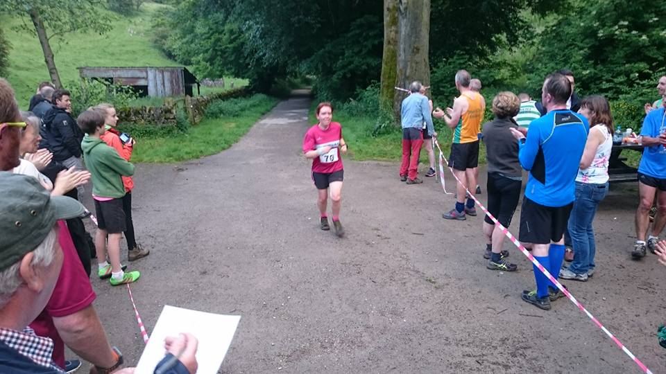
Hitting the top of the hill, I found my legs again and began to run. I could see Colette Holden in front of me, about 100m ahead. Collette had passed me on the hill climb and it was my determination to keep her in sight.
My standard approach to other runners of a similar ability level is to keep them close, about 50 m ahead and then plan a cavalry charge at the end. I saw Colette pass the barn on the crest of the hill, I’d cut her lead and was probably, 20 seconds behind her.
As soon as I hit the downhill, I started to increase my speed. At one point, she couldn’t have been more than 30 meters in front of me, but again fatigue set in and my resolve evaporated. I just couldn’t maintain the pace, having to stop for too many breathers.
The descent plunges down a green hillside and then into a small wood. The path is muddy and rocky. It ends with a long set of steep steps, which are lethal when wet. Even a “descent psycho” like myself gets nervy on them. They seem to go on forever and are just so steep. My knees were screaming by the time I crossed the river bridge to hit the tarmac at the bottom.
The Tar Stretch
At the bottom gates of Ravens Tor Youth Hostel, Colette was out of sight again. I increased my speed, and after about three minutes she was back in sight and only 50 meters ahead. I thought that if I could maintain the pace I might overtake her towards the end.
The ascent backup Tideswell Dale is a deceptively long drag, especially when you’ve just done the best part of a fell race. I tried to maintain my speed, increasing my steps, I closed on Colette, “this is it, I said to myself as I rounded the corner. Cramp was setting into the legs and suddenly something in my brain said “stop”.
I stopped for about 30 seconds, just to get some air and knowing all the time, that I’d just blown my last chance. I pressed as hard as I could on the final stretch going through the gate just before the quarry. As I rounded the first corner I could already hear the cheers as the crowd cheered Colette up the home straight.
Nothing left to do now but finish strongly. I rounded the final corner and the crowd started to cheer me on. I gave it my all, I am rather well known for my sprint finishes. It’s just a shame that I can’t find that speed earlier in races. I don’t get my legs till far too late.
Sprint Finish Photo: Jo Shimwell
A fantastic race by Colette has to be congratulated, especially that she’s been struggling with injury all year.
Colette at the finish. Photo: Andy Watkins
Conclusions
Tideswell Fell race is a fantastic race, really enjoyable. My time is down on last years, but I can cope. This was only my second race this year and my training has been patchy due to PF.
One thing this result tells me is that I really, really need to work on my fitness and stamina. This is been a consistent problem in races, giving up too easily when I need to keep going.
I am sure I need some kind of mental training. My weight is getting there, am capable of bursts of speed, so I don’t know what the issue is.
Any comments on this from experienced runners would be welcome.
If You Like This, You Might Like My Other Fell Running Articles
– Fell Running
On Stanage Edge, a great brown sea of Heather and Gorse, the moor, rushes up to Stanage Edge and stumbles over the many heads of the rock face.
The earnest facade of timeless rock shines out her many colours, standing proud in the cold light of winter, ripe with the shape nature has provided.
The wind whistles and whips round, and when she wants to be, is as warm as a country girl, who flirting, tickling here and there, planting warm breathy kisses upon the nape of your neck. Yet when her mood changes, she can be a wild and icy harridan, who could kill a man without pause for reflection, as she screams between the boulders.
Clouds, never far away, hang in the air, waiting to swoop and shroud the rocks in silky mist, forever changing, and rearranging the feel of the landscape.
Here and there, Rusty brooks bring forth the life blood of the moor, Water, a murderous colour stained red with Peat. Like a gentle, liquid knife it slowly cuts through the moor and rock alike.
As ramblers struggle over boulders squelch in bright black mud, a Jurassic sound stalks them, the Grouse laugh like naughty children as they play hide and seek with worried, wary walkers. stopping, peering as they try to pinpoint the sound.
Cuts and crags, nooks and caves call to people curious to know the moor, to try her, to own her, yet the scale of this fortress of wilderness swallows and humbles both man and beast, man cannot own this, nor digest this visual feast.
With senses overwhelmed a spell is cast that compels the moorland guest to return for pilgrimages uncounted.
If You Like this Post, Why not Link to it. With this code
On occasion my friend and I manage to co-ordinate our busy lives for long enough to get out into the Peak District countryside.
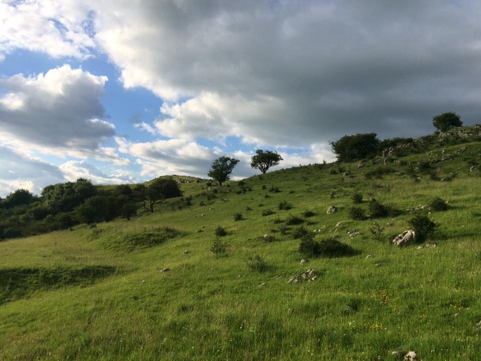
A few weeks ago we had planned to go over to The Roaches, The day arrived and of course, typically, it was pouring with rain. We decided to brave the elements and head out anyway, and I was so pleased that we did.
We drove from Wirksworth, turned onto Via Gellia, and up to Newhaven, turning there and driving down to the Monyash/Crowdetcote turning. From there, we went through to Longnor and then right across the moorland to Emerge on the A53 near The Winking Man Pub.
We turned left towards Leek, driving past the Ramshaw Rocks and the famous “Winking Man Rock”, (so called because the rock, which looks like a giant face that appears to wink at you when you drive past it. After half a mile or so we turned right at the sign for Upper Hulme.
For Upper Hulme – turn right
Follow the road past the pub, down the hill and take a sharp right. In the dip there are a few houses a small waterfall and some industrial units. Go past these and you’ll drive under the imposing outcrop of Hen Cloud.
Hen Cloud – It doesn’t really look like a Hen.
Path to the Roaches
A bit further on you’ll find some parking spaces and you can begin your walk.
We strolled though the mist, chatting away.
Staffordshire / Cheshire Borders
It’s good to just get out amongst the nature and walk. We could have driven a couple of miles up the road but would have missed, Buzzards, Kestrels, Horses, a young but sadly dead badger, a squashed Frog and a handsome Toad.
Juvenile Badger – Not a mark on it.
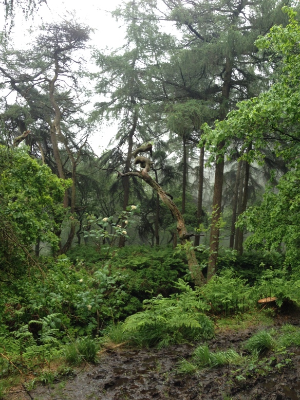
As we walked on, we neared the woods leading down to Ludds Church.
Woods containing Ludds Church
The photo looks almost flat but the descent into the woods was hard on my knees. We walked down and down and the rain eased up. This walk was fun, but there was a lot of mud, we had to carefully pick our way though a very muddy waterlogged wood, all the paths were thick with deep mud, so a little creative weaving through the Silver Birch trees was needed. Normally though, “stay on the path, kids”.
Misty, muddy Woods
Eventually we arrived at our destination. For those who don’t know what Ludds Church is, It’s a bloomin big chasm in the ground, you could easily miss it if you didn’t know it was there. Once you enter it, it’s a totally breathtaking micro-climate, like a little rocky gorge in a rainforest.
Ludds Church – Click for slideshow
Ludds Church
Entrance to Ludds Church
Ludds Church
Ludds Church
Ludds Church
Ludds Church
Ludds Church
Daws soaks up the Rain
Ludds Church is a real hidden gem and somewhere that I’d recommend anyoneto visit. I’m annoyed at myself for not having been before.
A little blurry but do you see the Green Man?
On the way back to the car our nature trail continued. There were contorted trees, with wonderful branch formations. My guess is that they must have been mauled by extreme weather and then healed, leaving truly creepily formed branches.Then there were ancient Beech trees with exposed roots, again looking as though they had seen a changing environment and adapted to it.
Daws looking out over the Staffordshire countryside
On the way, back we were lucky enough to find this handsome looking toad, who was kind enough to pose for photos.
We were treated to arial displays from a Buzzard and a Kestrel.
Buzzard with vole
Hovering Kestrel
Meanwhile, the sheep looked on.
Moorland Sheep
please leave a comment
If you liked this blog, please consider leaving a comment. Perhaps I missed something, or maybe you have a question, let me know.
Stoney Middleton Fell Race 2014 was the third race that I have missed through injury.
I can also say that whilst I’m gutted about not being able to run at the moment, I’m secretly happy that I didn’t have to run in the 30+ degree heat that we’ve been having this summer.
Whenever I’m not running, and can get to the race to support Tideswell RC, I take my camera along and try to snap team member and other runners in action. Sharing is caring and all that.
The Mother of all Hills
I thought I’d check out the route before the race kicked off, as I wasn’t familiar with the route and fancied finding a good vantage point to take pictures.
The route looks fairly gentle, to begin with, that is until you hit Stoney Middleton “High St”, I’m sure it got its name because, well, it’s high, very bloody high.
My little car found it tough going so Bing a frail human being huffing and puffing up it in the beating sun would be pretty tough going.
Running Groups Well Represented
The race itself started on Stoney Middleton playing fields. All the runners started arriving and there were plenty of running clubs represented. The ones I knew were,
Tideswell RC
Buxton RC
Goyt Valley Striders
Steel City Striders
Fat Boys
Totley
Ripley
Matlock
Sheffield
Dark Peak
A few of the teams were kind enough to let me take pics of them before the race.
Fat Boys Running Club
Steel City Striders
Ripley
Dark Peak
Goyt Valley Striders
The Race got underway from between the football goalposts.
Lining up
The race begins
A quick loop up the length of the field and down to the style to exit the field. Runners started off quick, to be first over the stile and to get a bit of a start for that hill.
Runners rush to reach the 1st stile
Due to the high number of runners though, the race was at a standstill within a minute as there was a near instant bottleneck at the narrow stile.
Bottleneck at Stile
This part was the only negative for me, but these things happen, and without issues like this, races would have nothing to improve on in coming years.
Within minutes, all the runners were off up the main road and heading toward “The Hill of Doom”. God pity their souls.
Being crocked, I wandered up the path and over the nearby fields to find a couple of decent vantage points for photos. Eventually, I settled on a nice spot down in a cool Valley just before the runners had their final ascent. I had a friendly marshal for company, and proceeded to prattle away to her whilst we waited for the pack to arrive.
Sadly, the pics were not the best, I must have had the camera on the wrong setting, but they are passable. So here they are.
Please leave a comment.
All pics are free to use and download but do please credit me “Tideswellman” by linking back to this post.
If You Like This, You Might Like My Other Fell Running Articles
– Fell Running
I entered my first Fell Race last night. It was a really hard route, but I managed to finish and I wasn’t last. I had previously only run the Chatsworth 10k, and the Tideswell Inter Inns Run. (5k). I was a bit nervous about doing a fell race, to be honest, because I’ve been suffering from Shin Splints for a while now, and didn’t think they could take it. The shins held out fine though, in fact, I’d say the Fell race was LESS painful than a full road run.
I’m completely amazed at how good every other runner is though. Big or small, old or young, there are some seriously dedicated runners out there, and I salute you all.
The Hathersage Gala Fell race was always going to be tough, knowing the terrain around there. I enjoy walking in that part of the Peak, so knew it would be challenging.
Tideswell RC at Hathersage Fell Race
Ben Brindley
Ben Brindley
Ben
Collete & Nigel
Home Straight
All photos borrowed from Facebook with thanks to Accelerate, Andrew Watkins & Kathryn Brindley.
I finished right near the back, but that’s fine for now. Thanks go to Nigel Jeff, who was spotting myself and Collette, and to Ben Brindley, who, running back, spurred me on for the last mile, and helped me attain a pretty fast sprint finish (According to Strava). Happy days indeed, I can’t wait for more races now.
If You Like This, You Might Like My Other Fell Running Articles
– Fell Running
A joint blog by Martha G and her dad, Tideswellman.
It was a lazy bank holiday Monday and we had a few hours to kill. My Dad is a bit of a walking nut, not in the sense of a pistachio with legs, but he has to trek up and down any valley he sees, Usually dragging me along with him.
Firstly we piled into the car, Dad never tells me where we are going until we get there. We went through Wensley and then passed through Winster. After that it’s up to Elton, Then through the hamlet of Gratton, where we saw some llamas resting in the field. About 2 mins later we a large Hare running through the field, they have an unusual way of running, they are like a kangaroo running on all fours.
[Dad] We drove down the valley and crossed over the bridge where the River Bradford flows underneath.
I always want to go walking alongside the Bradford, but there never seems to be anywhere to park. Today though I resolved to stop making excuses and to find somewhere to put the car. We drove up to the top of the village and parked on the Conksbury Road. I got Martha togged up in a rain mac, just in case of unexpected downpours, and we headed to the Church.
Martha’s right about me dragging her everywhere, but I’m just trying to give her a balanced view of the interesting history of the Peak District. It’s an area that has so many interesting places, It seems a tragedy to me to allow my kid to grow up here without seeing it or knowing at least a bit about it. Martha took control of the camera, I had my phone which has a reasonable camera too, So we went into the churchyard.
I pointed out some graves that had the name ‘Birds’ on them, as Martha has a friend with that surname. then we spotted a stone of a James Gregory, (my name. He’s actually related to my dad’s family). I’ve been to Youlgrave Church lots of times but Martha hadn’t, so I just let her lead really. Here are some of the Photos.
Youlgrave Church, Derbyshire. A fine unspoilt Churchyard. Full of historical headstones.
To the River
After the church we headed down Mawstone Lane, turning down a smaller lane called Stoneyside, where we met a lovely, friendly cat who made a big fuss of us. We did our best to return the favour. At the bottom of Stoneyside, we went through the gate into the field alongside the River Bradford.
River Bradford – Youlgrave
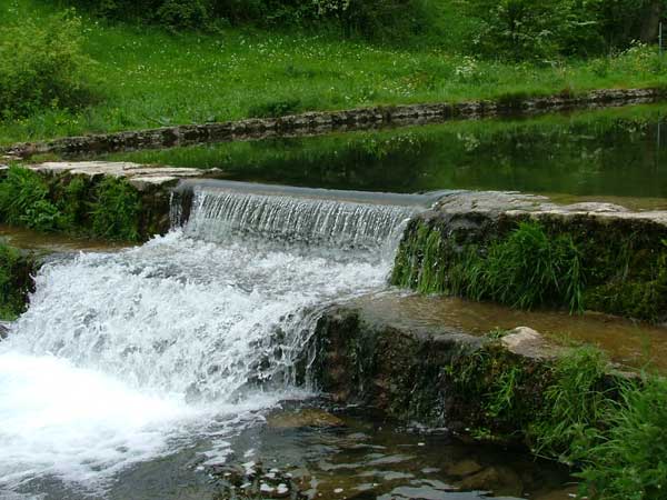
There were some Sheep and Cattle grazing the lush green grass and plenty of walkers on the trail. We didn’t want to go too far today because we didn’t have that much time. the River Bradford is so clear and pretty shallow. In places I’d say it was more of a stream than a river, but I’m guessing that it was once much deeper. I say that, because the river bed has been managed and there are 2 small weirs built into it, so I presume that somewhere along it’s course, there may have once been a mill or two. Perhaps someone who knows will comment below to put us straight?
Step weir,
Swimming Area In the River Bradford
We came to the main weir where we saw a sign actually sanctioning swimming. How fantastic, in this day of health and safety “over regulation” to see a sign effectively saying, “get on with it, at your own risk”. We Derbyshire folk are no namby pamby’s you know? A bit further up we came to a stile where the path met the limestone way. There was an overgrown path following the river, and a sign to refreshments, guess which path we followed? We headed up a steep tarmac path, which gave way to cobbles. along the path there were signs saying ‘Dying for a drink’. It turns out, that was the name of the Tea shop.
Dying for a Drink
‘Dying for a Drink‘, isn’t technically a shop, it’s a house that the owners open to hikers and locals, at Easter, Bank Holidays and Youlgrave Wakes. Tea and Cakes are available to order, and no price is charged, instead everyone is asked to make what they feel is an appropriate donation. What a fantastic idea. I do hope that everyone is fair with them. The house is perched on the side of the Valley overlooking the Bradford, and when sitting in the verdant terraced gardens, You can hear the river flowing below.
The staff/owners were all, shall we say, of advanced years. They were also super helpful and attentive, making sure we got a seat and ensuring that we had a drink and something to eat, despite the fact that we didn’t have much cash on us. Which I’m very grateful for. One lady, who was serving drinks must have been into her 60’s, she was whizzing up and down the steep garden steps, like a woman half her age.
Fantastic Paintings on Sale
When we first arrived I noticed a lady sitting at an easel, I went across to her and asked her if I could take a look. I peered around the easel and what I saw actually took my breath away. It was a stunning woodland theme, with light playing between the trees and hordes of springtime flowers.
Maureen Capewell – Artist
Very often, when faced with these situations you peer around the easel and have to nod and smile saying “oh wonderful”, whilst really thinking, “hmm, what is it?”. The artist was called Maureen Capewell.
I’d fully recommend you pay a visit to “Dying for a Drink” just to pick up her work, which is on sale there. It is truly excellent, and what better purchase than an original by a local artist? The chap who owned the house also came over to us for a quick chat, he told us that “Dying for a Drink“, donate the money they raise to help people in developing countries get clean water. They work with a charity called Tearfund. Tearfund are working with the Kigese Diocese Water and Sanitation Programme. I thought this was very apt, a perfect charity, because I was just enjoying a glass of cool local water. Youlgrave draws it’s own water supply from a local source that flows from the surrounding hills.
Everyone at “Dying for a Drink” did their best to make us feel welcome, Their customer service ( and Lemmon Cake) was so good, we simply had to give them and their great work a mention. I love their the name, ‘Dying for a drink’, it’s a statement so many of us utter flippantly, yet the people in Africa, who are now receiving the charitable donations literally were “dying for a drink”. A large party arrived, so we gave up our chairs and headed off back down the valley. Martha invented a sort of ‘Pooh Sticks’ game using buttercups instead of sticks and we wound our way back to the car, happy.
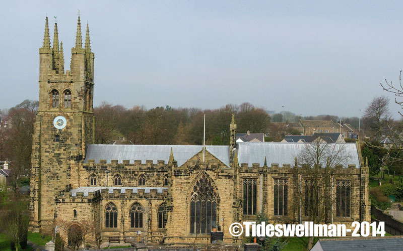
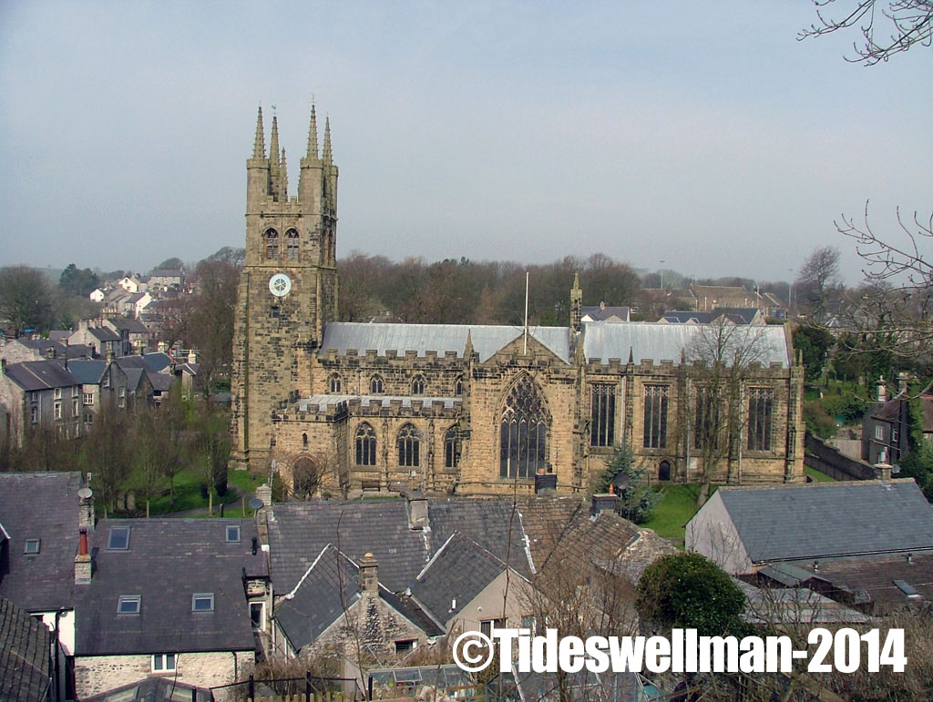
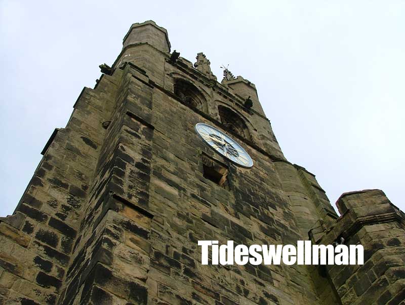
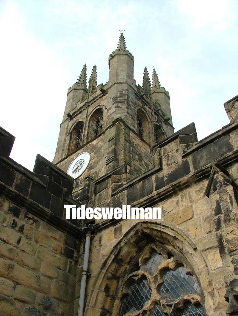
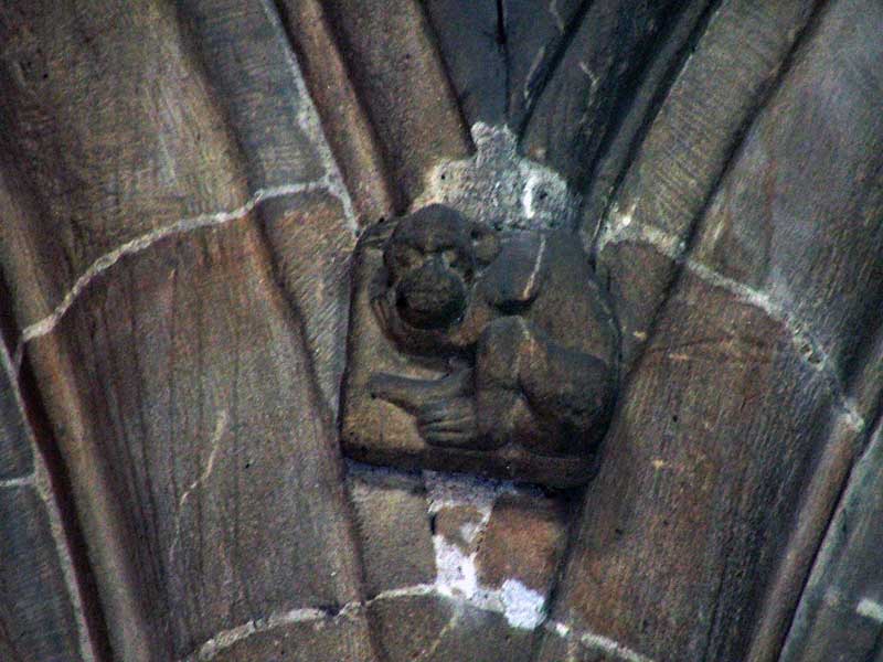
Tideswell church, St John the Baptist. Tideswell is a very large ‘Church of England’ Parish Church. It is one of the most important churches in Derbyshire.
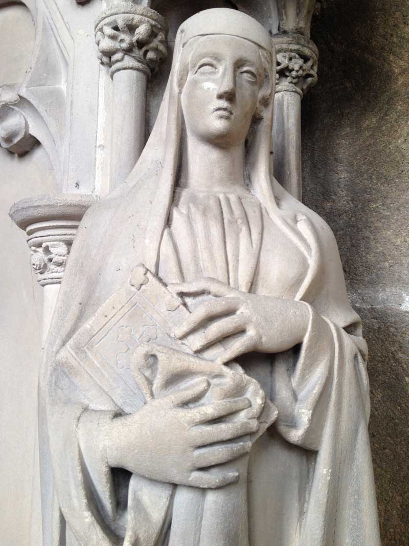
I lived in Tideswell until the age of 20. During that time, like most other Tideswellians whether young or old, I consider that I have a special relationship with Tideswell Church. I spent many hours bored rigid in there as a schoolboy, listening to religious services at Easter, Wakes, Harvest and Christmas. I had fun practising for School plays and concerts, I was scared by the creepy tombs, and marvelled at the stone cat and the monkey. I’ve been drunk in the Churchyard, in my teens, hanging out with friends in the churchyard till the early hours. I saw the Duke of Edinburgh there in the 80s, when he looked at our Cub Scout’s Welldressing. I have shared in sombre moments, attending funerals some of good friends and fellow Tideswellians. So it feels right, that I should pay some small tribute to a building that I love.
Tideswell Church – Cathedral of the Peak
About Tideswell Church
Tideswell church is famous locally, that is to say, within the Peak District, and perhaps Derbyshire, maybe also amongst those, who like me, appreciate churches and other ancient buildings. There is no doubt that it will have a memorable effect on anyone who has visited it.
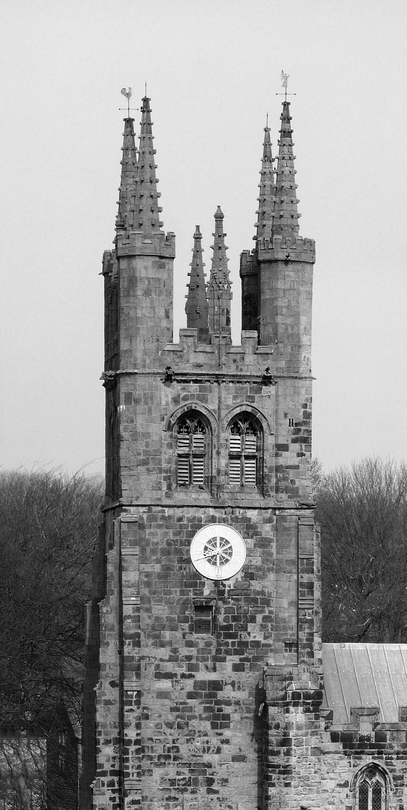
This Photo Shows the size of Tideswell church in comparison with local houses.
The reason that the church is so well known, is because of it’s size and striking architecture. Dubbed the “Cathedral of the Peak” (it is not a cathedral). It is one certainly amongst the most famous churches in Derbyshire, and is a Grade 1 listed building.
Tideswell Church has Norman Influences
The church, replaced a small Norman church, was constructed between approximately 1320 and 1400. The building work was delayed by the Black Death, which also hit nearby Eyam (Plague village). I always like to remind people that the plague wasn’t just in Eyam, but it seems that only Eyam is famous for it.
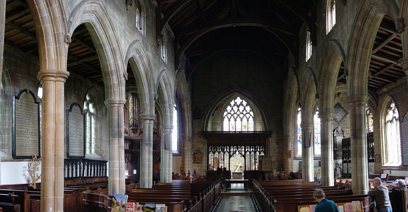
The Nave
There are two main styles to the building: the nave ( main body of the church), aisles Corridors) and transepts (wings) are in late Gothic style,(French style Architecture, characteristics include the pointed arch, the ribbed vault and the flying buttress.) and both the chancel (space around the altar) and tower are in perpendicular style.(Focusing on straight lines)
Tideswell Church
The perpendicular style became popular the Black Death which killed about half of England’s population in 18 months between June 1348 and December 1349 returning in 1361–62 to kill another fifth. This had a dramatic effect on the arts and culture, which it seems became very practical. The nation was affected by the labour shortages caused by the plague so architects designed less elaborately to compensate.
The church underwent was major restoration in 1873 by J D Sedding, which was truly a restoration rather than a reconstruction. In ‘Churches and Chapels in The County of Derby‘, Rawlins described St John’s as being:
“without exception, the most perfect and beautiful specimen of pointed architecture to be found in the County, – or perhaps in any other parish church of its size in the entire Kingdom“
Tideswell Church Tower
Catholicism in Tideswell
We often forget, that although today, most of our Parish Churches are ‘Church of England’. Many began life as Catholic Churches, Tideswell is no different. Bishop Pursglove, and Nicholas Garlic are Tideswells’ most celebrated and most notorious Catholic Clergy. Unlike local churches such as Hartington and Eyam, There are no signs of the fresco’s that would have covered the inside of the building in Catholic times.
Lichfield vs Lenton – The fight for Tideswell Church.
In 1250–51, the church became embroiled in a dispute between Lichfield Cathedral and Lenton Priory.
Tideswell was one of a several of parishes that had been given to Lenton Priory by the Peverel family during the 11th century. Later, their lands in the Peak District were seized by the crown and granted by King Henry II to his son William The Younger.
After taking the throne, Henry’s son, King John, granted the lands to the Bishop of Lichfield and in turn, they passed to the Dean and Chapter of Lichfield Cathedral.
This transfer began around 300 years of disagreement between the Priory and Cathedral about who was the rightful owner of the Tideswell Church. The legal battle continued throughout this period, including suits in the Vatican Court on several occasions.
Tideswell Church became directly involved in the dispute when in 1250–51, The monks of Lenton Priory armed themselves and attempted to steal wool and lambs from Tideswell,
The Dean of Lichfield Cathedral knew that Lenton would try such a manoeuvre, and ordered the wool and sheep to be kept within the nave of Tideswell church. Strangely, the monks of Lenton did not honour the church’s sanctuary rights, breaking into the building. A violent battle followed, and 18 lambs were killed within the church: either trampled under the horses’ hooves or butchered by the attackers. The Lenton, monks managed to carry off 14 of the lambs. (House of Cluniac Monks, Page, W 1910)
Despite a commission being assembled by Pope Innocent IV, which fined the monks of Lenton Priory severely for their actions. The disputes continued until King Henry VIII ordered the Dissolution of the Monasteries and Catholic power was smashed throughout the land.
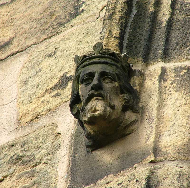
Notable Features in Tideswell Church
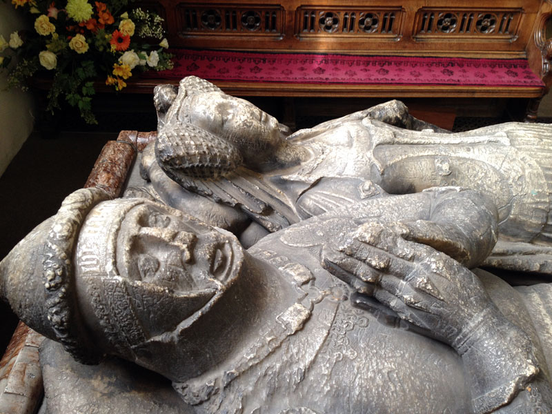
There are of course several notable features in, on and around the church. Some of the most notable items are the tombs in the Church. There are brasses to Sir John Foljamb, d. 1383 and to Bishop Robert Purseglove as well as several stone table tombs. These tombs used to fascinate and scare me as a kid, the thought of what might lie beneath them petrified me.
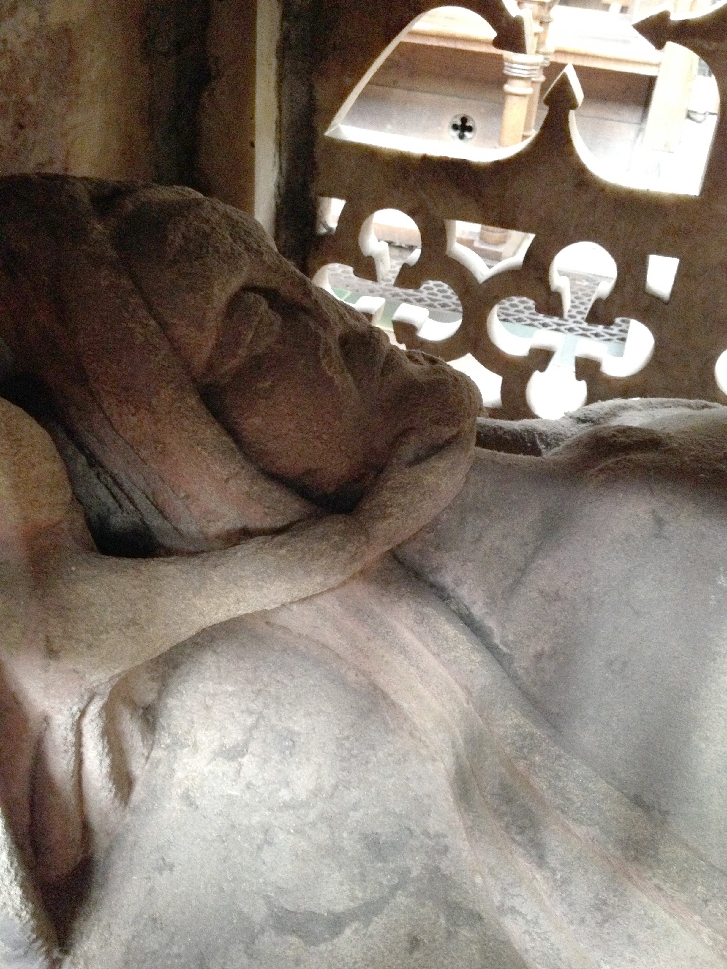
The Tomb of Sampson Meveril
In the middle of the chancel, there is an Altar tomb. Within lies Sir Sampson Meverill (1388–1462), allegedly one of the victors of Agincourt. Apparently, Sir Sampson was ‘a bit of a rum lad’. Not averse, in his day, to abducting Jurors, sent to try him. As a boy, this tomb always scared me because, beneath the marble slab, a stone cadaver lies. The stone corpse looks emaciated and creepy. Sampson’s head is held by an Angel, but the ravages of time make the Angel look more like some kind of evil Succubus. The top of the tomb is heavily inscribed and has an alabaster frieze and brass panels. The tomb was restored in 1876.
The Tomb of Sir Sampson Meveril in Tideswell Church
In the South Transept, there is the Lytton Chapel has one of the old bells on the floor, whilst nearby, is the tomb of Robert (d. 1483) and his wife Isabel (d. 1458) Lytton.
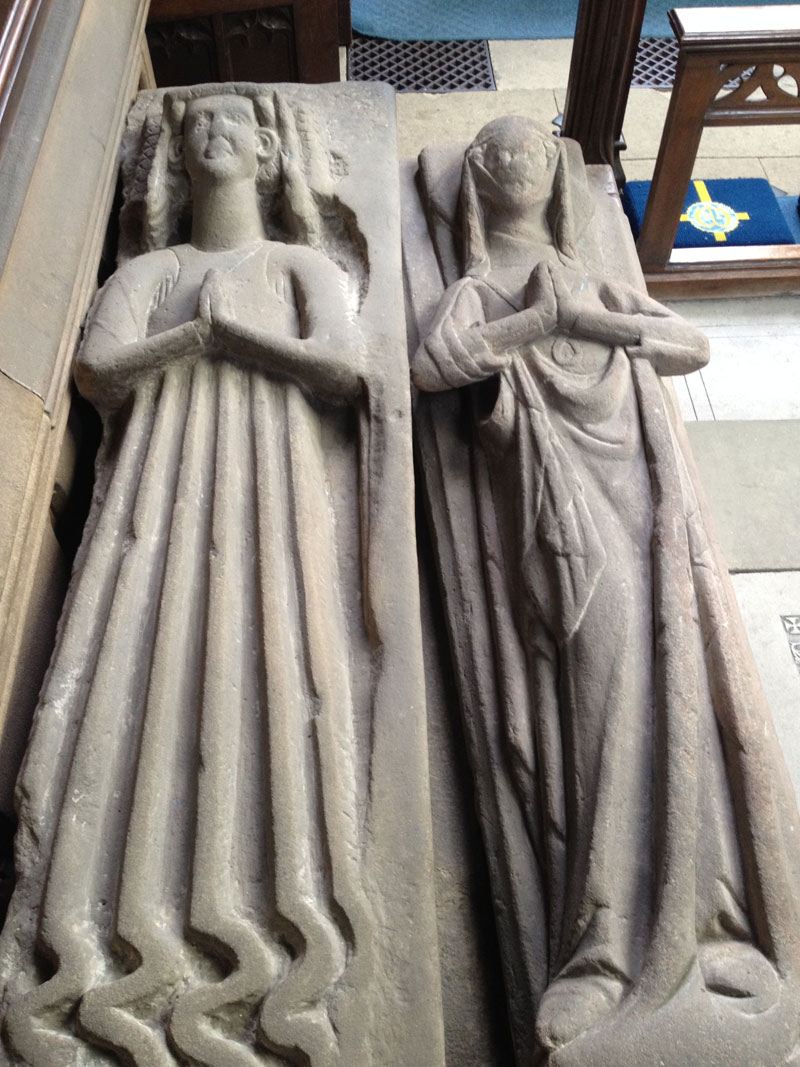
Mysterious Ladies from the 14th Century
The transcept also holds the effigies of two unknown ladies, these figures are thought to date back to the early 1300’s.
Stone Effigies – Tideswell Church
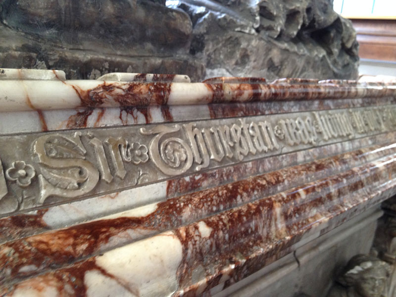
Sir Thurstan DeBower
Perhaps the church’s most notable feature is the ‘Bower Chapel’. This contains an impressive tomb, said to be that of Sir Thurstan De Bower and his wife Margret. the recumbent alabaster figures are extremely worn but remain impressive. Personally, I think it’s a tragedy that people have etched graffiti into the stone tomb, but most of it is very old by the look of it.
There is some debate raised by previous books about Tideswell, as to the true identity of these figures set in Alabaster. Local Historian, Rosemarie Lockie’s website has transcriptions that state contrary evidence. (See Related Links).
Sir Thurstram De Bower and his Wife Margaret?
Carved Inscription regarding Sir Thurstram – but is it accurate?
Thurstram Debower – Knight of Tideswell?, Benefactor of the Church
Is this the Debower tomb or an effigy to some other local Knight?
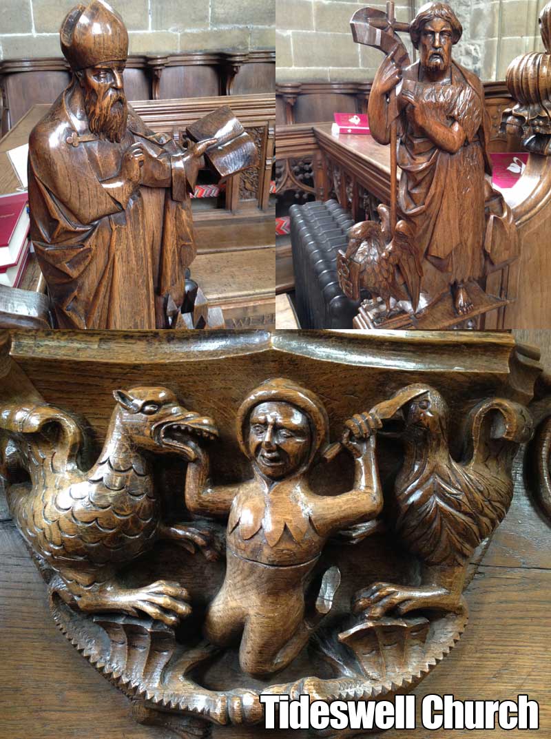
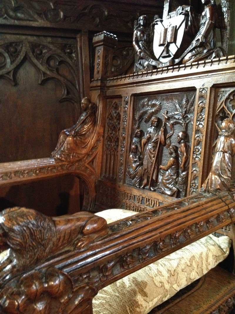
Wood Carvings
Tideswell Church is well known for the carvings of Advent Hunstone. Hunstone was A Tideswellman, who’s carvings adorn the great building, and many other local churches.
Not all the carvings in Tideswell church are Hunstone’s though.
Some in the chancel choir stalls are attributed to a Mr Tooley of Bury St Edmunds, Suffolk.
Wood Carvings at Tideswell
There are many other notable Features in Tideswell Church, probably too many to mention. Also, I think you should visit the church to get the real feel for it. Even locals, because when you walk past something every day, it can be, that you don’t really see it. You’ll be surprised at what you will spot for the first time.
Here are a few of my favourite features.
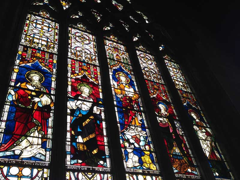
The Stained Glass at Tideswell is fantastic.
This figurine of Mary is hidden away behind the small Organ.
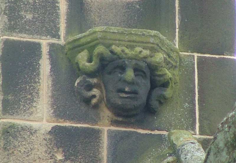
The Monkey, Often hard to spot…can you find him?
Possible Tunnel & Secret Crypt
There are those in the village who believe that Tideswell Church is connected to a series of other local buildings by a series of narrow tunnels. Some villages dismiss the idea out of hand whilst others swear to have been in them or recount tales of seeing family members in the Tunnels.
Today, those who know keep the secret. Those who want to know, like me have struggled to find out more than what is already known or supposed. You can read my posts about the tunnels under Tideswell Church here or just Google Tunnels under Tideswell. If the tunnels are there, what do they lead to? Some say they were escape routes for priests during the Reformation, others say that they were used to transport prisoners, and goods. Then there are those, who believe that the reason that Tideswell church is so large is that it hides a secret crypt of an important person. Whatever the truth is, I hope we all find out one day. I’m sure it would be a positive thing for the village, in terms of tourism, if the stories turn out to be true.
Share if you like, please
I do hope that you enjoyed my post about Tideswell Church. If you did, please leave a comment or at least like or Share on Facebook/Twitter/ Google Plus, Pinterest or whatever Social Network you favour.
No celebration in Tideswell would be right without the Tideswell Band playing the Tidza March, so here is Vernon Watson talking about how the Tidza march might have got to sound the way it does today.
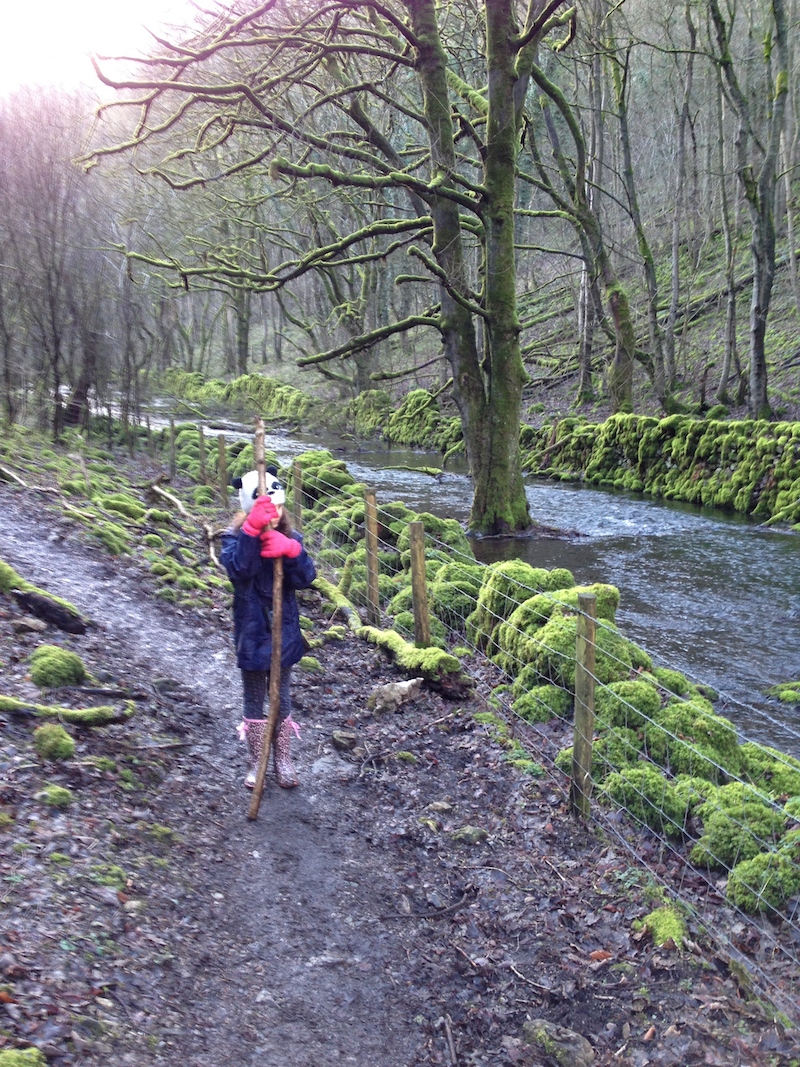
It was one of those lazy Saturdays. My partner was tied up with family matters and my daughter and I were at a loose end. The choice facing us was between festering inside on our respective electronic devices, or getting out into the fresh air for a spot of exploration. We chose the latter and made a quick packed lunch, and hopped into the car. As we drive the sun was streaming through the window and the clouds parted above offering us hope of a good afternoon’s walking.
Gibbet Rock / Peters Stone
When heading put on walks, I often decide en-route as to the destination. Sos as we headed through Bakewell I thought a trip toward Gibbet Rock, known by some as Peters Stone. There are several ways to get Peters Stone the way that I chose, wasn’t the best considering that I had my daughter with me. It had been some time since I had been there, and I somewhat under estimated the distance and the rough terrain. These things do happen.
Cressbrook Mill Millpond
We parked the car at Cressbrook Mill, and walked toward the old Mill pond on the right hand side of the road. The imposing mill on our left, almost shone in the cold and bright, January sunlight. We went toward the old Mill Pond and as we approached the gate we could hear the violent sound of rushing water, roaring as it entered the Mill Race. As I reached the gate and began to push it open, Martha was hanging back, somewhat cowed by the sound of the rushing water. I Went through the gate and was immediately confronted by a Kingfisher that almost flew right into me. Clearly the poor bird was as startled as I was, because it took off at speed. Luckily for Martha it had decided to fly around the perimeter of the Mill Pond instead of choosing a straight route to safety, so she did get to see it as it retreated, a blue/orange blur of bright feathers refleted on the shimmering pond. I will never forget that moment, I had never seen a kingfisher before and to see one so close, was a privilege that few people are ever afforded.
After waiting a few minutes, watching the Mill pond drain into the race, we headed up the steep hill towards the entrance to Ravensale.
Cressbrook Mill to Ravensdale
Ravensdale
It had been raining for days, this was the only fine day for a week or more. So, when we got down to the the Cottages at Ravensdale the path was little better than a sludge fest.
Despite our better judgement, we soldiered on.
The Mud in Ravensdale was bad.
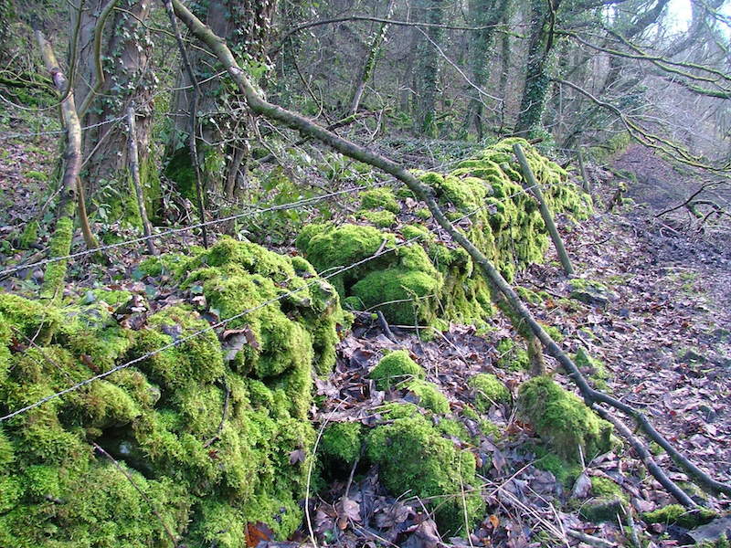
Quite soon it became evident that the dale itself must have its own micro climate, and a very damp one at that. All the drystone walls were completely blanketed in a thick jacket of emerald green moss. Not only the walls but the tree were thick with it too.
Mossy Walls
Muddy Ravensdale
As we pushed on through the thick mud, we came to a point where the stream flowing through the valley had spilled through the wall. I cannot really see the point of these walls as the land enclosed must be quite poor pasture. However, I do know that the valley isn’t always as wet as it was this year, so perhaps what I saw offered a distorted view of reality.
Water had burst through the wall.
The path meandered on and the woods were thick on both sides. eventually the path split into two and there was a steep climb and a lower path lose to the stream bed, Initially we climbed the hillside but were unsure as to the final destination of this path so clambered down to the lower path, where we saw some interesting trees.
Strange Ships Marooned upstream
Flooded Valley
I’m not sure how these trees are still standing, but what was clearly once just a field has now become the bed of the stream, and these trees are left stranded. Eventually over time, I guess their roots will wash out and the trees will tumble. Till then, they continue to be a notable feature on this unusual walk.
At this point I knew we weren’t far from breaking out of the woods, which I can tell you, I was glad of, the woods were damp and cool and nothing much seemed to stir in them except the stream. Eventually we turned a corner an came out into the open. We could see a party of hikers resting on the bank ahead and made our way toward them, it was time for quick bite to eat.
Break out of the Ravensdale wood and find a flooded valley
The Valley here was more flooded than I’d ever seen it before, though I hadn’t been here for some time. Perhaps there is some landscape engineering going on, but when I was a boy the valley was only wet in Winter and bone dry in Summer. The Wardlow Mires end of the valley, I have noted, now seems to be wet most of the year.
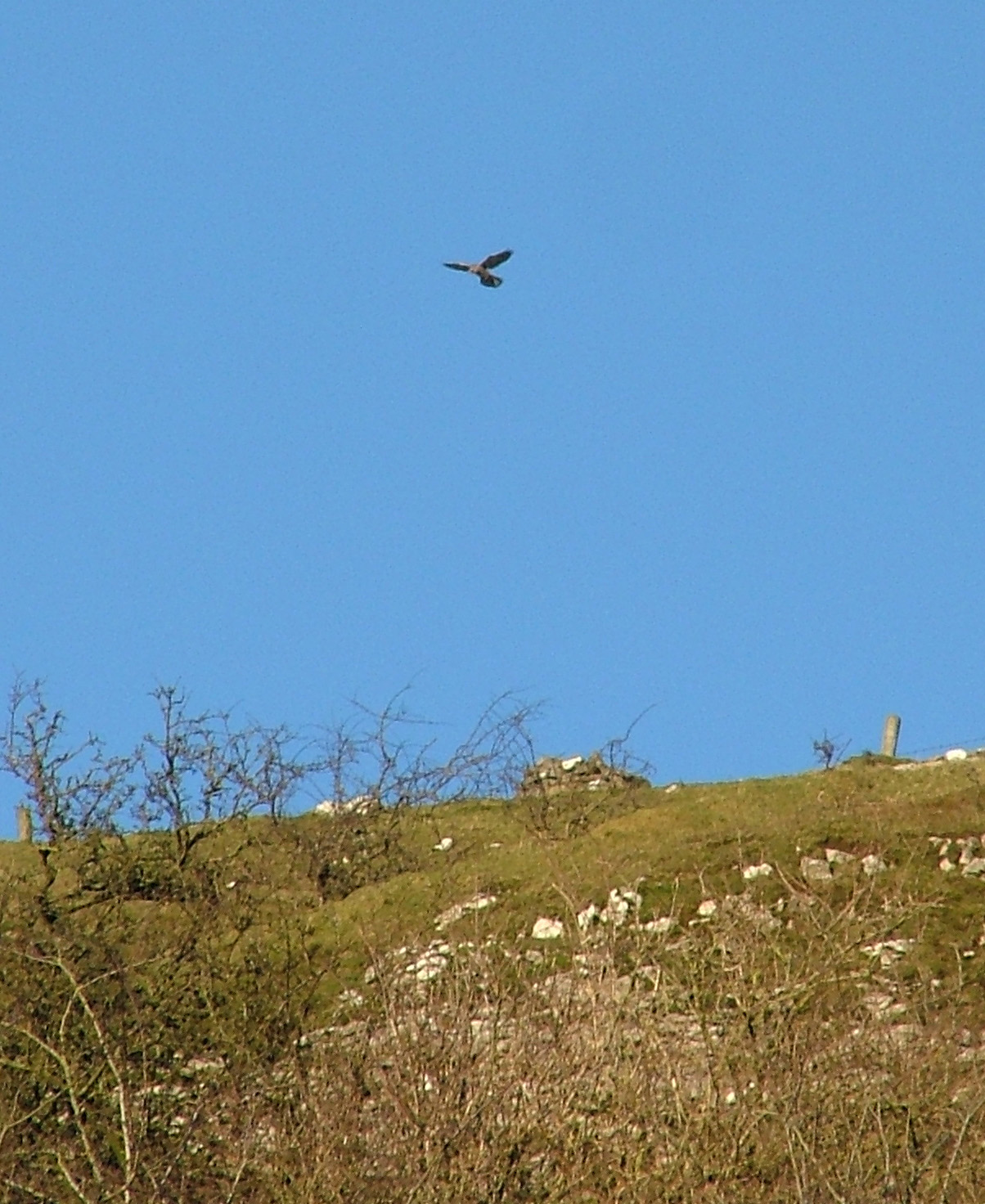
Peakland Kestrel
Whilst we finished our lunch, I spotted a Kestrel, hovering near the cliff edge. I often see Birds of prey using the Edges as cover in this way whilst they wait for a careless Rabbit or Vole to break cover.
Kestrel Hovers just behind the edge
We watched it hover for a while, then headed up the valley toward Gibbet Rock. Martha was getting tired, and so was I, the light was beginning to fade a little so I took the decision to head back, instead of going through the spooky woods again we took the path to the left which comes out in Litton, and then walked on the road to Cressbrook.
The Litton Path
As we climbed the steep path, I began to realise just how badly I had underestimated the difficulty of this walk for a 9 year old, who wasn’t raised as an outdoors kid. It was challenging enough for me, so she was doing really well. there was nothing else for it though, I had to get us back to the car before dark.
Looking back toward the dale, the edge is where we saw the Kestrel.
Litton & Cressbrook bound
We walked on until we hit the tar road. Unexpectedly, Martha’s mood seemed to lift then, and we were more lighthearted for the remainder of the trip. Sometimes, I think kids just need to know the end is in sight.
Our mood was crowned by the fact that we saw this truly beautiful sunset that seemed as though it would set the fields on fire with molten gold, smelted in the furnace of the heavens.
Litton – A Golden Sunset.
minutes later we were looking down on Cressbrook Mill, the starting point of our journey. Next time I will recalibrate the walk, heading from Wardlow Mires to Gibbet Rock, lunch on the rock and then back for ice cream at Monsal Head. I think I owe her that much.
A really nice, and simple walk in the Darley Dale, Matlock Area is the one over the Holt Rd. It’s a reasonably simple walk in terms of distance but it does have some steep ascents and descents.
We simply start by driving up Greenaway Lane.
Turn off the A6 up Greenaway Lane
Follow the road around until you see a small Methodist Chapel on the right. You can park in this area, but please be considerate and don’t block the road or pavement. The photo below Shows you where to park and how to walk up past the Christmas Tree Nursery onto the Hold Rd. * You can also get onto the Holt rd by approaching Hackney on Hackney Rd from the Matlock end. (down Smedley Street, then up Farley Hill, Turn immediate Left past the Laburnum inn)
Holt Rd Walk. Park near the Methodist Chapel.
Once on the Holt Rd, you have a short walk to the end of the road. Here the road becomes a track unsuitable for motors. follow the track through the woods. There are some great old trees to see, and you should be able to hear the sound of running water below you.
The woods are full of freshwater springs and they all flow into Sydnope Brook which runs down into Two Dales. Eventually you come to a fork in the path. Here in the Winter or after heavy rain a spring flows over the top of a drystone wall, and often down the path.
You can either carry on over the top of Fancy Dam and all the way up towards Darwin Lake or you can take the stream worn path down the hill. We chose the latter. Follow the path down the bank and you will be above the brook and the last of the three dams, where if you’re lucky a Heron can often be seen.
Just below this is a pretty Waterfall, worth a photo or two. From here you can walk down the path to the right which leads past a mill and down toward the road in Two Dales. Or you can swing left up a rather steep path. which will bring you right back where you started off on the Holt Rd.
The Holt Rd Walk – approx 2 miles
There are several variations to this simple walk, and I should stress that this is the least adventurous of many versions we have done. Sometimes you just need a leg stretching walk that gets you out for a bit of fresh air.
If you have a walk in the local area and you’d like to share it with me, please leave a comment below and I’ll be in touch.
A couple of weeks ago I took my daughter and met up with some friends, we had decided to walk up Carl Wark with the possibility of continuing on up Higger Tor.
I wasn’t sure whether the kids were up to the walk but it pretty soon transpired that they were more than equal to the trek.
Carl Wark
Carl Wark is a rocky outcrop on Hathersage Moor in the Peak District National Park, just outside the boundary of Sheffield. Carl Wark is basically a flat topped hill known as a promontory. It has rocky faces all round which are great for bouldering and scrambling. Apparently one side, is protected by a prehistoric embankment, but you wouldn’t really know that unless you knew what you were looking for.
Wikipedia says :
“The cliffs and embankment form an enclosure that has been interpreted as an Iron Age hill fort, though the date of construction and purpose of the fortifications remains unknown.”
I first spotted Carl Wark as a boy, but had no idea what it was. Years later up on my return to the Peaks, it was one of the first places I sought out.
One of the best routes to Carl Wark is to park at the side of the road by the Fox House inn. There is a style to a footpath that leads right over the fields and down towards the escarpments.
Walking from Fox House Inn to Carl Wark is about 0.91 miles
As you head across the fields watch out because it can be a bit boggy in wet weather. Hopefully you’ll have some decent walking boots, Trainers (sneakers) will do, but will most likely get wet.
After the bogs, you come to another stile, go over it and you come to a low rocky outcrop, great for kids and adults alike to climb and feel the bracing wind in your face.
Boulders on Hathersage Moor
Looking toward Carl Wark and Higger Tor
Walking towards Carl Wark, past the boulders.
After the boulders, start to pick your way down the hillside, you’ll see a path below you. Once you get to the path you should be able to hear Burbage Brook. This is the fun part..cross the brook. It’s more than passable even after plenty of rain. Keep your wit’s about you though, because it’s possible to slip and fall in. At it’s deepest, the crossing point is about knee height, but slip over and you’ll get a wet bum for sure.
Burbage Brook Crossing Point
After that, you are home free. Pick your way up to Carl Wark, watch out for the marshy ground again though. It looks a bit further away than it really is, you’ll be up there in minutes.
Looking towards Cark Wark
Carl Wark is a suitable walk for children. My daughter about to conquer some more boulders.
Once up on Cark Wark you’ll be windswept. I think this is a great place to sit down catch your breath, enjoy the view and maybe break out the Sandwiches. (Don’t forget to take your litter home with you though).
After you’ve caught your breath, take a look around you, there are some terrific views.
This will be when you set your sights on Higger Tor.
If you’re feeling tired, don’t worry Higger Tor will wait till the next time. If however, you feel like pushing on, It took us (3 x 39 yr olds and 2 kids under 13) about 10 minutes to get from the top of Cark Wark to the top of Higger Tor, so it’s more than manageable.
Carl Wark to Higger Tor took 10 minutes
Once you get to the summit, you are greeted by more dramatic views. Huge tumbledown rockfalls, and weathered stacks make this walk one of the most engaging family walks around the area.


 Then further on we were treated to the great escarpments of the downfall, there were some seriously big rocks all stacked up rather precariously.


 I fully accept that my becoming a Vegan won’t change the fate of billions of animals worldwide, but what it will do is remove my money and endorsement from that system of animal slavery, torture and death.


 Sometimes, It’s best to just have a short trot out without too much pressure. Runs are always harder when you’re not in the mood, so why put added pressure on yourself by not knowing the distance and conditions?
 My issues arose from footwear. A few weeks ago I picked up some


 Then there were ancient Beech trees with exposed roots, again looking as though they had seen a changing environment and adapted to it.


 A large party arrived, so we gave up our chairs and headed off back down the valley. Martha invented a sort of ‘Pooh Sticks’ game using buttercups instead of sticks and we wound our way back to the car, happy.